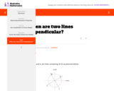
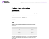
This is a task from the Illustrative Mathematics website that is one …
This is a task from the Illustrative Mathematics website that is one part of a complete illustration of the standard to which it is aligned. Each task has at least one solution and some commentary that addresses important aspects of the task and its potential use.
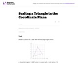
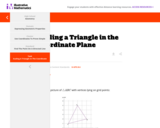
This is a task from the Illustrative Mathematics website that is one …
This is a task from the Illustrative Mathematics website that is one part of a complete illustration of the standard to which it is aligned. Each task has at least one solution and some commentary that addresses important asects of the task and its potential use. Here are the first few lines of the commentary for this task: Below is a picture of $\triangle ABC$ with vertices lying on grid points: Draw the image of $\triangle ABC$ when it is scaled with a scale factor of $\...
This is a task from the Illustrative Mathematics website that is one …
This is a task from the Illustrative Mathematics website that is one part of a complete illustration of the standard to which it is aligned. Each task has at least one solution and some commentary that addresses important aspects of the task and its potential use.
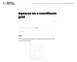
This is a task from the Illustrative Mathematics website that is one …
This is a task from the Illustrative Mathematics website that is one part of a complete illustration of the standard to which it is aligned. Each task has at least one solution and some commentary that addresses important asects of the task and its potential use. Here are the first few lines of the commentary for this task: In the picture below a square is outlined whose vertices lie on the coordinate grid points: The area of this particular square is 16 square units. For ...
This is a task from the Illustrative Mathematics website that is one …
This is a task from the Illustrative Mathematics website that is one part of a complete illustration of the standard to which it is aligned. Each task has at least one solution and some commentary that addresses important aspects of the task and its potential use.
This is not a typical e-book; it is a free, web-based, open-source …
This is not a typical e-book; it is a free, web-based, open-source “textbook” available to anyone interested in using mapping tools to create maps. This e-text focuses primarily on Geographic Information Systems (GIS)—a geospatial technology that enables you to create spatial databases, analyze spatial patterns, and produce maps that communicate more effectively. While this GIS textbook is principally an introduction to GIS, most of the chapter’s concepts are applicable to other geotechnologies including remote sensing, global positioning systems (GPS), Internet mapping, and virtual globes.
Creating good maps and analyzing spatial data is a time consuming and challenging practice, but recently, a new set of powerful mapping tools has enabled almost anyone with a computer to make maps easily and to perform at least some low-level analyses. The results, however, are not encouraging. Most of the new mapmakers do not have adequate training in mapping concepts and spatial analysis principles, and their maps are often improperly designed and do not communicate easily nor effectively. This e-text—GIS Commons—seeks to help you analyze spatial data and communicate more effectively. In short, GIS education is our goal.
The concept of geocaching is introduced as a way for students to …
The concept of geocaching is introduced as a way for students to explore using a global positioning system (GPS) device and basic geographic information (GIS) skills. Students familiarize themselves with GPS, GIS, and geocaching as well as the concepts of latitude and longitude. They develop the skills and concepts needed to complete the associated activity while considering how these technologies relate to engineering. Students discuss images associated with GPS, watch a video on how GPS is used, and review a slide show of GIS basics. They estimate their location using latitude and longitude on a world map and watch a video that introduces the geocaching phenomenon. Finally, students practice using a GPS device to gain an understanding of the technology and how location and direction features work while sending and receiving data to a GIS such as Google Earth.
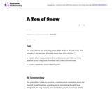
This is a task from the Illustrative Mathematics website that is one …
This is a task from the Illustrative Mathematics website that is one part of a complete illustration of the standard to which it is aligned. Each task has at least one solution and some commentary that addresses important asects of the task and its potential use. Here are the first few lines of the commentary for this task: Eric and Julianne are shoveling snow. After an hour of hard work, Eric remarks ''I bet we have shoveled more than a ton of snow.'' Explain what measure...
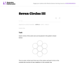
This task complements ``Seven Circles'' I, II, and III. This is a …
This task complements ``Seven Circles'' I, II, and III. This is a hands-on activity which students could work on at many different levels and the activity leads to many interesting questions for further investigation.
This is a task from the Illustrative Mathematics website that is one …
This is a task from the Illustrative Mathematics website that is one part of a complete illustration of the standard to which it is aligned. Each task has at least one solution and some commentary that addresses important asects of the task and its potential use. Here are the first few lines of the commentary for this task: The following clip shows the famous opening scene of the movie Raiders of the Lost Arc. At the beginning of the clip, Indiana Jones is replacing the go...
This task provides an opportunity to model a concrete situation with mathematics. …
This task provides an opportunity to model a concrete situation with mathematics. Once a representative picture of the situation described in the problem is drawn (the teacher may provide guidance here as necessary), the solution of the task requires an understanding of the definition of the sine function. When the task is complete, new insight is shed on the ``Seven Circles I'' problem which initiated this investigation as is noted at the end of the solution.
This task is inspired by the derivation of the volume formula for …
This task is inspired by the derivation of the volume formula for the sphere. If a sphere of radius 1 is enclosed in a cylinder of radius 1 and height 2, then the volume not occupied by the sphere is equal to the volume of a Ňdouble-naped coneÓ with vertex at the center of the sphere and bases equal to the bases of the cylinder.
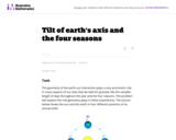
This is a task from the Illustrative Mathematics website that is one …
This is a task from the Illustrative Mathematics website that is one part of a complete illustration of the standard to which it is aligned. Each task has at least one solution and some commentary that addresses important asects of the task and its potential use. Here are the first few lines of the commentary for this task: The geometry of the earth-sun interaction plays a very prominent role in many aspects of our lives that we take for granted, like the variable length o...
Students design their own logo or picture and use a handheld GPS …
Students design their own logo or picture and use a handheld GPS receiver to map it out. They write out a word or graphic on a field or playground, walk the path, and log GPS data. The results display their "art" on their GPS receiver screen.
Students familiarize themselves â through trial and error â with the basics …
Students familiarize themselves â through trial and error â with the basics of GPS receiver operation. They view a receiver's satellite visibility screen as they walk in various directions and monitor their progress on the receiver's map. Students may enter waypoints and use the GPS information to guide them back to specific locations.
Students go on a GPS scavenger hunt. They use GPS receivers to …
Students go on a GPS scavenger hunt. They use GPS receivers to find designated waypoints and report back on what they found. They compute distances between waypoints based on the latitude and longitude, and compare with the distance the receiver finds.
This is a freshman advising seminar. The professor of a FAS is …
This is a freshman advising seminar. The professor of a FAS is the first year advisor to the (no more than 8) students in the seminar. The use of Global Positioning System (GPS) in a wide variety of applications has exploded in the last few years. In this seminar we explore how positions on the Earth were determined before GPS; how GPS itself works and the range of applications in which GPS is now a critical element. This seminar is followed by a UROP research project in the spring semester where results from precise GPS measurements will be analyzed and displayed on the Web.
During a scavenger hunt and an art project, students learn how to …
During a scavenger hunt and an art project, students learn how to use a handheld GPS receiver for personal navigation. Teachers can request assistance from the Institute of Navigation to find nearby members with experience in using GPS and in locating receivers to use.
This is a task from the Illustrative Mathematics website that is one …
This is a task from the Illustrative Mathematics website that is one part of a complete illustration of the standard to which it is aligned. Each task has at least one solution and some commentary that addresses important asects of the task and its potential use. Here are the first few lines of the commentary for this task: In the July 2013 issue of United Airlines' Hemisphere Magazine the following article appeared: Write down an equation that describes Captain Bowers' me...
This is a task from the Illustrative Mathematics website that is one …
This is a task from the Illustrative Mathematics website that is one part of a complete illustration of the standard to which it is aligned. Each task has at least one solution and some commentary that addresses important aspects of the task and its potential use.
No restrictions on your remixing, redistributing, or making derivative works. Give credit to the author, as required.
Your remixing, redistributing, or making derivatives works comes with some restrictions, including how it is shared.
Your redistributing comes with some restrictions. Do not remix or make derivative works.
Most restrictive license type. Prohibits most uses, sharing, and any changes.
Copyrighted materials, available under Fair Use and the TEACH Act for US-based educators, or other custom arrangements. Go to the resource provider to see their individual restrictions.