This first year Geography textbook takes a holistic approach to Geography by …
This first year Geography textbook takes a holistic approach to Geography by incorporating elements of physical, human and regional geography, as well as bringing in methods and perspectives from spatial information science.. This textbook applies a fundamental geographical approach to understanding our globally changing world by looking at local processes which are linked to larger global processes and events. For example mining and its effects are a global issue and we can see how these unfold in BC. A further example is the recent apology to First Nation peoples on the residential school treatment, as similar events occur in the US, Ireland and Australia. Processes of urbanization, a phenomenon which people all over the globe are experiencing, can be seen in Vancouver with our discussion of the citys development. Geography students, indeed all first year students, need to be able to critically assess their own contexts and environments in order to properly engage with our continually globalizing world.
This activity proposes different small experiments and discussions to show that in …
This activity proposes different small experiments and discussions to show that in the summer it is cooler by the sea than on the land and that water cools off more slowly than soil.
Students learn about local and planetary physical geography / geology, toponymy, planetary …
Students learn about local and planetary physical geography / geology, toponymy, planetary landing site selection and cartography. The students learn a complex process of landscape evaluation and city planning, based on the interpretation of photomaps or digital terrain models.
Geographic information systems (GIS), once used predominantly by experts in cartography and …
Geographic information systems (GIS), once used predominantly by experts in cartography and computer programming, have become pervasive in everyday business and consumer use. This unit explores GIS in general as a technology about which much more can be learned, and it also explores applications of that technology. Students experience GIS technology through the use of Google Earth on the environmental topic of plastics in the ocean in an area known as the Great Pacific Garbage Patch. The use of this topic in GIS makes the unit multidisciplinary, incorporating the physics of ocean currents, the chemistry associated with pollutant degradation and chemical sorption to organic-rich plastics, and ecological impact to aquatic biota.
Students pass around and distort messages written on index cards to learn …
Students pass around and distort messages written on index cards to learn how we use signals from GPS occultations to study the atmosphere. The cards represent information sent from GPS satellites being distorted as they pass through different locations in the Earth's atmosphere and reach other satellites. Analyzing GPS occultations enables better global weather forecasting, storm tracking and climate change monitoring.
An engineering and design lesson for middle school (our 7th grade standards). …
An engineering and design lesson for middle school (our 7th grade standards).
In the aftermath of a natural disaster, can you engineer a device that will keep medicine within a 40-60°F range using natural resources from the biome you live in, and/or debris created by the disaster for three days, until the Red Cross can arrive?
You are a team of relief workers in __________________after a major earthquake/tsunami has occurred. Your team lead as just told you about a young women with diabetes has been injured and needs insulin to be delivered __________ miles away (no open roads). Your team will need to research, design, and build a portable device to keep the insulin between _____ and ______ °(F/C) for _____ days. Once you return you will present the effectiveness of your device to your lead and a team other relief workers showing your both your design/device and explaining the process.
Essentials of Geographic Information Systems integrates key concepts behind the technology with …
Essentials of Geographic Information Systems integrates key concepts behind the technology with practical concerns and real-world applications. Recognizing that many potential GIS users are nonspecialists or may only need a few maps, this book is designed to be accessible, pragmatic, and concise. Essentials of Geographic Information Systems also illustrates how GIS is used to ask questions, inform choices, and guide policy. From the melting of the polar ice caps to privacy issues associated with mapping, this book provides a gentle, yet substantive, introduction to the use and application of digital maps, mapping, and GIS.
This is not a typical e-book; it is a free, web-based, open-source …
This is not a typical e-book; it is a free, web-based, open-source “textbook” available to anyone interested in using mapping tools to create maps. This e-text focuses primarily on Geographic Information Systems (GIS)—a geospatial technology that enables you to create spatial databases, analyze spatial patterns, and produce maps that communicate more effectively. While this GIS textbook is principally an introduction to GIS, most of the chapter’s concepts are applicable to other geotechnologies including remote sensing, global positioning systems (GPS), Internet mapping, and virtual globes.
Creating good maps and analyzing spatial data is a time consuming and challenging practice, but recently, a new set of powerful mapping tools has enabled almost anyone with a computer to make maps easily and to perform at least some low-level analyses. The results, however, are not encouraging. Most of the new mapmakers do not have adequate training in mapping concepts and spatial analysis principles, and their maps are often improperly designed and do not communicate easily nor effectively. This e-text—GIS Commons—seeks to help you analyze spatial data and communicate more effectively. In short, GIS education is our goal.
Essentials of Geographic Information Systems integrates key concepts behind the technology with …
Essentials of Geographic Information Systems integrates key concepts behind the technology with practical concerns and real-world applications. Recognizing that many potential GIS users are nonspecialists or may only need a few maps, this book is designed to be accessible, pragmatic, and concise. Essentials of Geographic Information Systems also illustrates how GIS is used to ask questions, inform choices, and guide policy. From the melting of the polar ice caps to privacy issues associated with mapping, this book provides a gentle, yet substantive, introduction to the use and application of digital maps, mapping, and GIS.
Geo-information has proven to be extremely helpful in many aspects of risk …
Geo-information has proven to be extremely helpful in many aspects of risk and disaster management: locational and situational awareness, monitoring of hazards, damage detection, sharing of information, defining vulnerability areas, etc. This course aims to provide knowledge on risk and disaster management activities, demonstrate use of geo-information technologies in emergency response, outline current challenges and motivate young geo-specialist to seek for advanced solutions. The course is organised as lectures and practicals. The practicals will be in the form of group assignments. Some excursions and guest lectures will be organised as well.
With this activity, students use a globe to learn how a position …
With this activity, students use a globe to learn how a position on Earth can be described. They investigate how latitude can be found using the stars. Students learn what latitude and longitude are and how to use them to indicate a position on Earth. They investigate how in some locations on Earth, the direction of the midday sun can change over the year.
The purpose of this text is to promote understanding of the Geographic …
The purpose of this text is to promote understanding of the Geographic Information Science and Technology enterprise (GIS&T, also known as “geospatial”).
This lesson unit provides an insight into the navigational methods of the …
This lesson unit provides an insight into the navigational methods of the Bronze Age Mediterranean peoples. The students explore the link between history and astronomical knowledge. Besides an overview of ancient seafaring in the Mediterranean, the students use activities to explore early navigational skills using the stars and constellations and their apparent nightly movement across the sky. In the course of the activities, they become familiar with the stellar constellations and how they are distributed across the northern and southern sky.
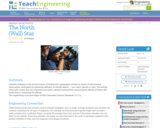
Celestial navigation is the art and science of finding one's geographic position …
Celestial navigation is the art and science of finding one's geographic position by means of astronomical observations, particularly by measuring altitudes of celestial objects sun, moon, planets or stars. This activity starts with a basic, but very important and useful, celestial measurement: measuring the altitude of Polaris (the North Star) or measuring the latitude.
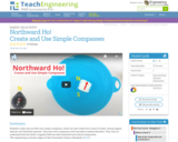
Students create and use their own simple compasses, which are each made …
Students create and use their own simple compasses, which are each made from a bowl of water, strong magnet, stick pin and Styrofoam peanuts. They learn how compasses work and about cardinal directions. They come to understand that the Earth's magnetic field has both horizontal and vertical components.
Physical Geography, also called earth science, is the study of our home …
Physical Geography, also called earth science, is the study of our home planet and all of its components: its lands, waters, atmosphere, and interior. In this book, some chapters are devoted to the processes that shape the lands and impact people. Other chapters depict the processes of the atmosphere and its relationship to the planets surface and all our living creatures. For as long as people have been on the planet, humans have had to live within Earths boundaries. Now human life is having a profound effect on the planet. Several chapters are devoted to the effect people have on the planet.The journey to better understanding Earth begins here with an exploration of how scientists learn about the natural world and introduces you to the study of physical geography and earth science.
In this unit, students learn the very basics of navigation, including the …
In this unit, students learn the very basics of navigation, including the different kinds of navigation and their purposes. The concepts of relative and absolute location, latitude, longitude and cardinal directions are explored, as well as the use and principles of maps and a compass. Students discover the history of navigation and learn the importance of math and how it ties into navigational techniques. Understanding how trilateration can determine one's location leads to a lesson on the global positioning system and how to use a GPS receiver. The unit concludes with an overview of orbits and spacecraft trajectories from Earth to other planets.
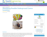
Students use their knowledge of scales and areas to determine the best …
Students use their knowledge of scales and areas to determine the best locations in Alabraska for the underground caverns. They cut out rectangular paper pieces to represent caverns to scale with the maps and place the cut-outs on the maps to determine feasible locations.
The goals of this textbook are to help students acquire the technical …
The goals of this textbook are to help students acquire the technical skills of using software and managing a database, and develop research skills of collecting data, analyzing information and presenting results. We emphasize that the need to investigate the potential and practicality of GIS technologies in a typical planning setting and evaluate its possible applications. GIS may not be necessary (or useful) for every planning application, and we anticipate these readings to provide the necessary foundation for discerning its appropriate use. Therefore, this textbook attempts to facilitate spatial thinking focusing more on open-ended planning questions, which require judgment and exploration, while developing the analytical capacity for understanding a variety of local and regional planning challenges. While this textbook provides the background for understanding the concepts in GIS as applicable to urban and regional planning, it is best when accompanied by a hands-on tutorial, which will enable readers to develop an in-depth understanding of the specific planning applications of GIS. Chapters in this text book are either composed by the editors using Creative Common materials, or linked to a book chapter scanned copy in the library reserve. In the end of each chapter, we also provided several discussion questions, together with contextual applications through some web links.
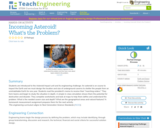
Students learn of the impending asteroid impact scenario, form teams and begin …
Students learn of the impending asteroid impact scenario, form teams and begin to study the situation in depth. A simple in-class simulation shows them the potential for destruction and disaster. They complete worksheets and look at maps to help them define and understand the problem: What is the needed cavern size and depth? What are the geographical areas and natural features? A homework measurement assignment prepares them for the next lesson/activity.
No restrictions on your remixing, redistributing, or making derivative works. Give credit to the author, as required.
Your remixing, redistributing, or making derivatives works comes with some restrictions, including how it is shared.
Your redistributing comes with some restrictions. Do not remix or make derivative works.
Most restrictive license type. Prohibits most uses, sharing, and any changes.
Copyrighted materials, available under Fair Use and the TEACH Act for US-based educators, or other custom arrangements. Go to the resource provider to see their individual restrictions.